HUNTING MAPS AND GPS
Map Your Hunt
To map your hunt, you will need to make use of both free online resources, and tools that you can purchase to give you the cutting edge technologies to help you with your hunt. I use google maps for a free resource with their satellite view, I purchase a good map book, I bought a nice Handheld GPS, along with the software from onX Hunting Maps. The details of each are shown below.OnX Hunt GPS Maps
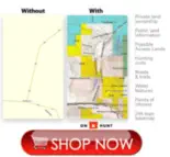
One of my favorite tools to help me in my pre-season scouting is OnXMaps for Hunting. You get highly detailed maps at your fingertips with private land ownership information, public land information, hunting units, roads, trails, water features, points of interest and a topo basemap. This is especially beneficial for me when I get drawn to hunt in a zone that I am not familiar with, to help me get up to speed quickly, and to make sure I am hunting in a spot that I can hunt in. It also helps me as I travel through the zone and I see a piece of land, or a gate that I want to locate the owner and get permission, or pay a trespass fee to get on some good hunting land. I also use it in my neighborhood to learn who my distant neighbors are, when the need arises. The onX Hunt maps are a really great tool.onX Hunt Map Features
OnXMaps also has State Specific information for Game Management or Hunting Units, Hunter access programs, Conservation and program lands. Also included is Road and Trail Data where you can view city, highway, county, Forest Service, back-roads, trail systems, and more. The HUNT Membership includes maps and information for phone, tablet, and your computers. I use OnXMaps to identify property boundaries. I used to spot deer herds, and big bucks, and not be able to tell if I am still in my zone, or still withing the property boundary of my hunting area to be able to shoot. I always error on the side of caution, and do not take the shot. I would pull out maps, and my gps, and try to figure it out, but it takes too long. With OnXMaps, I always know exactly where the boundaries are, and if it’s ok to shoot. By far the most time saving piece of equipment that I have.Handheld GPS for Hunting
It’s also important to have a handheld GPS to install the OnXMaps onto. I prefer the Garmin Montana 680t handheld GPS. The Garmin Montana 680t handheld GPS has these amazing features: Rugged GPS/GLONASS with 8 Megapixel Camera and Preloaded TOPO Maps 4-inch dual-orientation, glove-friendly touchscreen display 8 megapixel autofocus camera; automatically geotags photos Tracks both GPS and GLONASS satellites Preloaded TOPO U.S. 100K maps; includes 1-year BirdsEye Satellite Imagery subscription 3-axis compass with barometric altimeter With this GPS you will know your exact location with extreme accuracy, and coupled with the OnXMaps for hunting, you will know whether you are on public or private land, and whether it is legal to hunt. Take the stress out of trying to pinpoint your exact location, take the guesswork out of knowing where the property boundaries are, and do yourself the favor of buying both OnXMaps and the Garmin Montana 680t GPS, and you will be impressed.Handheld Hunting GPS
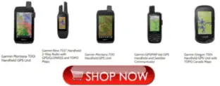
• Garmin Montana 700i Handheld GPS Unit • Garmin Rino 755t Handheld Two Way Radio With GPS Topo Maps • Garmin Montana 700 Handheld GPS Unit • Garmin GPS Map 66i GPS Handheld and Satellite Communicator • Garmin Oregon 750t Handheld GPS Unit with TOPO Canada MapsHunting Map Books
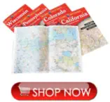
If you are into the more traditional paper maps, or want a paper map to supplement your GPS maps, I recommend the Delorme Atlas & Gazetteer. Amazingly detailed and beautifully crafted, large format paper maps for all 50 states. Topographic maps with elevation contours, major highways and roads, dirt roads, trails and land use data. Gazetteer section contains information essential for any outdoor enthusiast, such as points of interest, landmarks, state and national parks, campgrounds, boat launches, golf courses, historic sites, hunting zones, canoe trips, scenic drive recommendations and more. The available information varies by state. Perfect for sightseeing, exploring back roads, outdoor recreation and trip planning.Satellite Hunting Maps
One main resource that I use for hunting information is actually free. I like to use Google Maps and turn on the satellite view. With Satellite view you can see your hunting grounds from high overhead to look for areas to target in your hunting. You can look for creeks or watering holes, you can look for meadows and dense brush where the animals may be hiding. I like to scout online in the off season when I can’t hunt, to look for better places to do my hiking and hunting. Valuable resource, and amazing that it is free. About The Author Mike Mendenhall is the the founder of Mendenhall Outdoors. This website is an extension of the Mendenhall family’s lifestyle and passion for the great outdoors. Everything that they learn, and experience, along the way that they find may be valuable to our website visitors is on the site for you to enjoy. We highlight products and services that you might find interesting. We frequently receive free products from manufacturers to test. This does not drive our decision as to whether or not a product is featured or recommended. If you click a link on this page, then go on to make a purchase, we might receive a commission – at no extra cost to you, and does not impact the purchase price of any products that you may purchase. The Best Hunting Maps and GPS Experience Awaits!


Website Designed By Mendenhall Family Enterprises
MENDENHALL OUTDOORS © 2025
Privacy Policy
copyright


